Camors - Circuit de l'étoile
Camors
73 Rue de l'Étang
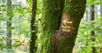
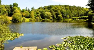
56330 CamorsDuration : 2h15 Distance : 9 km Difficulty level: Medium Yellow markings - All year - Possible MTB The forest of Camors, the Petit Bois site and the megaliths are on the program of this hike. Departure: Leave Le Petit Bois, a park dedicated to relaxation, recreation and sports with a pond where you can fish, picnic areas, a sports course and a tree climbing park. Walk along the accrobranche park on the right, take an old hollow road. Go straight up to the small stream, cross it, turn right to "line Noë Marrec". Follow it to the left. 1 At 200 m, turn right. Follow a narrower trail to the roundabout of the star. Take the Croix Tortorec forest line. At 100 m, on the right, see Menhir Braz, the "Great Menhir" (over 3 m high), also named "Menhir of the Star".This stele, erected in the Neolithic and classified as a Historic Monument, is more than 5,000 years old. Continue, turn left onto the nursery road. At the road, turn right on 50 m. 2 Turn right on the path between the old Lambel school and the forest. Go straight, cross the forest line of Croix Tortorec, continue to the railway line "Auray-Pontivy". Follow it on the right, pass under the small tunnel. At the forest path of Nerven, turn left for 100 m then right towards the pond of the Vieille Forêt. Along the pond, go up a path on the left. At the Old Forest line, turn right to the railway line. Go along it on the left. 3 Cross a second small tunnel, turn right, follow the railway to the Nerven line. To see: Menhir Bihan (200 m on the right) or the "small menhir" in Breton, also classified as Historic Monuments. See also the wash house of Fionnec (to the left of the line).Go straight, cross the road to take the line of Loges (new arboretum). Take a small path on the right. Cross the forest road, go straight to the line of Noë Marrec. Go up on the right. Turn left on a small path back to the starting point.
Retrouvez ce parcours sur l'application mobile Loopi
Scannez le QR code, enregistrez en favoris ou lancez le guidage, il n'y a plus qu'à profiter !
Scannez le QR code, enregistrez en favoris ou lancez le guidage, il n'y a plus qu'à profiter !
Revêtement des voies
9.74 km sur revêtement non renseigné dans la base de données Open Street Map
Ce parcours est proposé par: Office de tourisme de la Baie de Quiberon
Soyez prudent et prévoyant lors de vos escapades. Loopi et l'auteur de cette fiche ne pourront pas être tenus responsables en cas de problème survenu sur ce parcours.


