Belz - Pointe de Larmor
Belz
15 Rue de Port Niscop
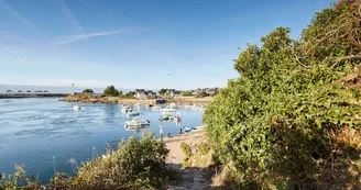
56550 BelzDuration : 1h30 Distance : 5 km Difficulty level: Easy Yellow markup All year This walk will take you along the Etel River, a marine gulf with picturesque landscapes. You will then follow the shores of Sac'h, its tributary, which is here one of the many inlets of the Ria. Departure: At the car park of Port Niscop, admire lePont Lorois, the only passage between the two banks of the Ria and between Auray and Lorient. Completed in 1841, it was destroyed twice (1,894 and 1,944). His name comes from Édouard Lorois, Prefect of Morbihan from 1838 to 1848. Leave the parking lot and take the coastal path at the end of the wharf. Bypass a shipyard by borrowing one end of the Rue des Chantiers. Then take again on the right lesentier which goes along the river of Etel. 1 At the tip of Royanec, continue the path.At the tip of Roquenec, reach the mouth of the Sac'h River. 2 Continue the coastal path to the Moulin du Bignac. This tide mill was built around 1856 by Mr. Paissel, who then acquired the inlet to turn it into a pond. There remains today only the dam blocking the Bignac cove and the solid foundations of a building built partly on this dike. It was coupled with a tower-shaped windmill, probably built during the same period, now transformed into a private house. 3 At the Mill, turn left on a path along the Etang du Bignac. The site of the pond and the moors of Bignac composes an exceptional natural space (classified Natura 2000). In this landscape alternate gorse, heather, ponds and wet meadows. The panicaut viviparous (Eryngium viviparum), a discrete plant of extreme rarity (the only station listed in France to date), makes the Bignac an exceptional site. At the bridle continue on the right by the path that goes through woods and moors.Continue along the small street and turn left onto Larmor Road. 4 After 250 m, take the small path that goes down to the right. Continue right again at the pond to join the Venelle de Mané Braz. 5 Take a right again on Rue du Chantier for 100 m, then turn left on a small path to reach Port Niscop. Focus: • Lorois bridge: single passage between the two banks of the Ria and between Auray and Lorient. Completed in 1841, it was destroyed twice (1894 and 1944). His name comes from Edouard Lorois, Prefect of Morbihan from 1838 to 1848. • The cave of Port-Niscop: oratory dedicated to Our Lady of Lourdes, the cave was erected by the sailors for their companions dead at sea. The pardon takes place every year on August 15 (Assumption).
Find this route on the Loopi mobile app
Scan the QR code, save it as a favorite, or start the guidance, just enjoy!
Scan the QR code, save it as a favorite, or start the guidance, just enjoy!
Road surfaces
231 m on asphalt or tarred road
5.00 km on unknown surface in the Open Street Map database
236 m on rolling path (compacted sand, gravel, cobblestones)
1.02 km on trail and off-road track
This route is provided by: Office de tourisme de la Baie de Quiberon
Be cautious and prepared during your outings. Loopi and the author of this sheet cannot be held responsible for any problems that occur on this route.


