Brec'h - Circuit de St-Dégan et la vallée de Tréauray
Brech
10 Rue Park Segal
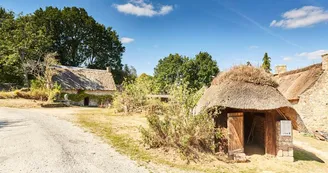
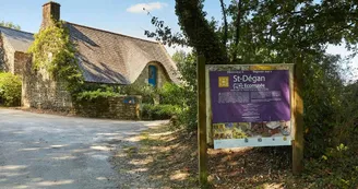
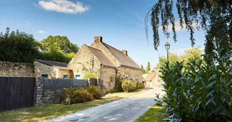
56400 BrechDuration : 2h Distance : 8 km Easy Yellow markings - All year - Possible MTB Saint-Dégan concentrates various historical and natural heritages: the valley of Tréauray and the river of Loc'h, the cottage village of Saint-Dégan, the chapel Saint-Quirin and its fountain known as healer and the conservatory orchard. Step by step : From the parking, take the path of the garden of the old meadow, continue left in the village to reach a hollow road. The Écomusée Saint-Dégan allows the discovery of the daily life of the Pays d'Auray, the activities of the different generations, their close link with the landscape, nature, festivals and customs. Visit furnished houses, cottage (seventeenth century), farmhouse (nineteenth century) and outbuildings (information 02 97 57 66 00). Continue on the undergrowth path that runs alonga small stream before going up on the left after the big stone. 1 Up, continue straight to join a large track, old Roman road, take it to the left. 2 To visit the Chapelle Saint-Quirin, turn right at the intersection of the road with the road then left at the village of Saint-Guérin. This 17th century chapel houses a classic altarpiece attributed to a Master Lavallois. Built in tufa and marble of Maine, this masterpiece is considered one of the most beautiful altarpieces of Morbihan. Formerly, the Chapel was very busy. It invoked Saint Quirin to help children walk (open every day from June to September). Go to the healing fountain by the dirt road to the right of the chapel. Associated with the chapel, the fountain of Saint-Quirin had a reputation for curing various ailments. Retrace your steps and go down the wide path to the Roman bridge of Kerfroud. 3 Retrace your steps for 100 m, turn right on the path lined with stone walls.After 200 m, take the steep path to the left, continuing along a beautiful hollow road. 4 At the road, take the left to Kerguéro, pass the water tower, turn right in the street of the Moulin d'Estaing. 5 After the village, turn left towards the forest road and continue straight. Go down to the edge of Loc'h then continue through the moor, the undergrowth. Bypass the conservatory orchard of Saint-Dégan, departmental site classified Natural Sensitive Area. This orchard contributes to the safeguarding and valorization of the species and varieties of Breton fruit trees. It hosts more than 200 fruit varieties (mainly apple, plum, pear) now protected. 6 Join an asphalt road, take it straight to a road. Turn left, then 50 m further to the right to reach the car park. Focus: • The Ecomuseum of Saint-Dégan allows the discovery of the everyday life of the Pays d'Auray of the past, the activities of the different generations, their close link with the landscape, nature, festivals and customs. Visit of furnished houses, thatched cottage (17th century), farmhouse (19th century) and outbuildings. Information: 02 97 57 66 00. • The chapel and the Saint-Quirin fountain: the building (17th century) houses a classic altarpiece attributed to the Laval Masters. Built in tufa and marble of Maine, this masterpiece is considered the most beautiful altarpiece of Morbihan. Formerly, the chapel was very busy, it invoked Saint-Quirin to help children walk. His fountain had a reputation for curing various ailments. Open regularly during the day. • The Saint-Dégan conservation orchard is a departmental site classified as a Sensitive Natural Area. This orchard contributes to the safeguarding and valorization of the species and varieties of Breton fruit trees.It hosts more than 200 fruit varieties (mainly apple, plum, pear) now protected.
Find this route on the Loopi mobile app
Scan the QR code, save it as a favorite, or start the guidance, just enjoy!
Scan the QR code, save it as a favorite, or start the guidance, just enjoy!
Road surfaces
2.62 km on asphalt or tarred road
4.48 km on unknown surface in the Open Street Map database
1.69 km on trail and off-road track
This route is provided by: Office de tourisme de la Baie de Quiberon
Be cautious and prepared during your outings. Loopi and the author of this sheet cannot be held responsible for any problems that occur on this route.


