Plouharnel - Circuit de Sainte Barbe
Plouharnel
10 Rue du Ouahre Ste Barbe
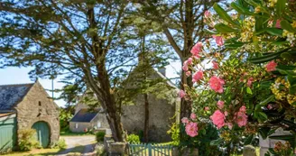
56340 PlouharnelDuration : 1 hour Distance : 5.3kmEasy Yellow markup The Breton village of Sainte-Barbe braves the wrath of the ocean under the protection of its chapel. Isolated, the villagers lived there in family clans, narrow crosspieces connecting the dwellings. Step by step : Departure: Opposite the entrance to the chapel, go to the right. Go past a fountain, turn left. After the washhouse, follow the path to the fork, see an old windmill (private property).1- Panoramic view of the ocean, the dune belt, the wetland and the landier, the village of Sainte-Barbe. Turn right at the engraved stone, arrive by a small wooden bridge in the commune of Glevenay (to see: old wash house restored by the villagers). Enter the village, take the path to the right and, to the left, the Chemin de Lostiguen. Continue left.2- Cross the road, take the path opposite before the railway to Kerfourchelle. Cross the D781.Follow the trail. View of the alignments of menhirs of the Vieux Moulin. With your back to the alignments, take the path opposite.3- At the next intersection, continue straight on the path. Find the GR®34.4- At the next crossing, possibility to find Sainte Barbe directly via Kerpontic and the Kersily campsite. Otherwise, continue straight until Kerarno.5- Cross the Kerarno road to reach the Saint-Antoine Chapel. Continue the path.6- At the entrance to the hamlet of Kergazec, take the road to the left as far as the secondary road. Cross it and follow it to the left for about fifty meters then take the first path on the right. 7- Continue the path to Sainte-Barbe. Take Rue de Kernizan to cross the village. Then turn left rue du Kreisker to find the Chapel. A) A primitive chapel was founded on the return from a crusade. The facade of the Sainte-Barbe chapel (11th century), listed, is in the Renaissance style. The main event of the Revolution in Brittany took place there: the landing of the emigrants, known as the “Quiberon Expedition” (July 1775).It was exposed again in 1940: the Germans, surrounded by the allies, withdrew to 200 bunkers built in the dunes. B) The large dune site, as far as the eye can see, harbors many plant species sometimes protected at European level (Loesel's snakeskin, summer tress) for their scarcity. To discover: carnation of the dunes, sea grape, maritime panicaut, santolina maritime.
Find this route on the Loopi mobile app
Scan the QR code, save it as a favorite, or start the guidance, just enjoy!
Scan the QR code, save it as a favorite, or start the guidance, just enjoy!
Road surfaces
5.20 km on unknown surface in the Open Street Map database
This route is provided by: Office de tourisme de la Baie de Quiberon
Be cautious and prepared during your outings. Loopi and the author of this sheet cannot be held responsible for any problems that occur on this route.


