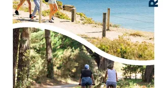
Locmariaquer - Entre Golfe et Océan
Locmariaquer
2 Rue de la Victoire
56740 LocmariaquerDuration: 2h Distance: 8 km Difficulty level: Easy Yellow markers, purple markers - All year round A route to discover the different facets of Locmariaquer: the town and the port, the megalithic sites and remarkable natural spaces. Departure: Opposite the tourist office, take the alley of the Schools then turn right in the lane of Bronzo. On your left, possibility of access to the dolmen Mané Réthual. Built almost 6,000 years ago, in the Neolithic, this tomb of nearly 20 meters long consists of a corridor leading to a burial chamber. In the alley, you will come across the Menhir Men Bronzo, broken in two parts. Built in the Neolithic, it has two engravings on one of its faces, a butt and a bird, hardly visible to the naked eye today. Continue and descend towards the old cemetery. Turn left.Go to the parking of the site of Megaliths, Place L'Helgouac'h (information www.site-megalithique-locmariaquer.fr). Walk along the stadium car park and take the path along the Cresuidi housing estate. Turn left on the path to Kerlud. 1 At the entrance of the hamlet, admire the Kerlud Dolmen, a tomb built on a similar plane to the Er Grah Tumulus. The monument extends over a large part of the field. Turn right and take the coastal path then turn left at Toul Keun. Follow the coastal path to the Flat Stones covered Alley. This tomb is composed of a long corridor bent 24 meters with, in the corner, a side cabinet. It leads to a funeral chamber. 12 pillars supporting the cover slabs are decorated with engravings. Listed as a Historic Monument in 1889, the monument has undergone several restorations. The stone standing in front of the tomb is actually a slab that was lying at the entrance.Continue along the beach of Falaise and Rolay beach to the tip of Kerpenhir (entrance to the Gulf of Morbihan). Views of Port Navalo and the Bay of Quiberon. 2 Continue along the coastal path, on the left, and see the menhirs group of Men Letionnec (a standing menhir and several beds). Menhirs lines extend under water and are visible during high tides. In front of the center Ker-Yvonnick, turn right on the road. Walk for 500 m to the oyster farm "Les Viviers de Locker": see the Tumulus of Mané er Hroëk, monument of the Neolithic consisting of a vault included in a colossal tumulus. It is now accessible by a staircase made in the early twentieth century. The monument has been cut off by agricultural activity and housing construction. Menhirs are visible around the monument. Return to the site, pass it and turn, 100 m, into the impasse of Tal Hir. Take the coastal path between two property walls. Continue to the pier Guilvin (beware: narrow path with stairs). 3 Pass the hold, walk along the Hotel Le Neptune. After 250 m on the path, take the small road on the left then right on Rue Lafayette to join the Church Notre-Dame de Kerdro, Dariorigum square and the Port.
Find this route on the Loopi mobile app
Scan the QR code, save it as a favorite, or start the guidance, just enjoy!
Scan the QR code, save it as a favorite, or start the guidance, just enjoy!
Road surfaces
858 m on asphalt or tarred road
4.21 km on unknown surface in the Open Street Map database
1.02 km on rolling path (compacted sand, gravel, cobblestones)
2.13 km on trail and off-road track
This route is provided by: Office de tourisme de la Baie de Quiberon
Be cautious and prepared during your outings. Loopi and the author of this sheet cannot be held responsible for any problems that occur on this route.


