Crac'h - Circuit cyclo - Douar ha Mor
Crach
1 Place René Le Mené
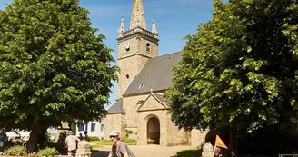
56950 CrachDuration: 1h15 Distance: 14,5 km Difficulty level: Easy - All year long This pleasant walk reveals a magnificent view of the Auray river and the rural heart of the town through fields and woods. Departure Place Le Mené, facing the Town Hall, take direction Le Tourbillon then the D28 towards Kerfacile until the junction of the Roman road. 1 Take the Roman road to Kerguinouret, take the VC201 for 200 m before taking the direction of Penhouët, then drive to Lomarec with this beautiful view of the Auray river. In Roman times, an aqueduct straddled between Crac'h and Pluneret. The red buoy, called "Caesar Buoy", in the river marks the location of the remains of the monument. 2 In Lomarec, visit the Chapel dating from the early 17th century and has a granite Merovingian sarcophagus with the following inscriptions:IRHAEMA + INRI. The Apostle Saint Andrew is honored with the power to cure whooping cough, probably because his name has a certain homonymy with the Breton word "an drew" or "an driu" which designates this disease. Outside, 50 m from the chapel, see the twin fountains (wetland). 3 At D28, the crossing is secure. Go up through the village of Kerdavid passing near the oldest tree of the town: a chestnut tricentenaire, classified in the remarkable trees of Brittany. 4 At the exit of the village, at 100 m, enter the marked path to Kerfourchard, then Kerdolmen and Kervive. See the fountain and menhir Kervive menhir erected in the Neolithic (7000 years to 4500 years before the present). Follow Kersinge, then Le Lerré and Kerbiscam through the Crac'hoise countryside. See the Cross of Kerbiscam. Of great height, the cross is removed in the moor not far from the road. It is located on the old road that connected Kericard to Kerbiscam. 6 Take the direction of the town center along the villages of Kéricart and Petit Cosquer.
Find this route on the Loopi mobile app
Scan the QR code, save it as a favorite, or start the guidance, just enjoy!
Scan the QR code, save it as a favorite, or start the guidance, just enjoy!
Route development
84% shared roads
15% cycle paths
Road surfaces
1.28 km on asphalt or tarred road
5.32 km on unknown surface in the Open Street Map database
5.75 km on rolling path (compacted sand, gravel, cobblestones)
1.41 km on trail and off-road track
This route is provided by: Office de tourisme de la Baie de Quiberon
Be cautious and prepared during your outings. Loopi and the author of this sheet cannot be held responsible for any problems that occur on this route.


