Locmariaquer - Circuit cyclo - Le grand tour
Locmariaquer
Rue Wilson
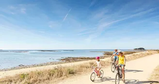
56740 LocmariaquerDuration : 1h30 Distance : 12 km Difficulty level: Easy This tour takes you to the great natural and megalithic sites of Locmariaquer: the village, the Table des Marchands, Saint-Pierre Lopérec, the flat stones covered Alley, Kerpenhir and the entrance to the Gulf of Morbihan. Departure: From the Wilson car park, take the rue de la Plage then join the megaliths road by the cycle route at the roundabout of Kerlud, towards Auray. Passage near the site of Megaliths (possibility of visits), bringing together several megalithic monuments:the Great broken menhir (4,500 BC), the largest monolith erected by man at that time (21 m long and weighing an estimated 330 tons), the Er Grah Tumulus (168 m length 30 m wide) and the Dolmen of the Table des Marchands, falls in a corridor with several slabs decorated with engravings (excavated and restored in the late nineteenth and early twentieth century, its last restoration dates from 1991). The site is managed by the Center of National Monuments (information www.site-megalithique-locmariaquer.fr). 1 Walk along the Stadium car park, direction Kerlogonan, turn left after the subdivision in the path towards Kerlud then turn right at the next intersection towards Kerhelle. In Kerhelle, take the cycle route on the left in the direction of Saint-Pierre Lopérec then, at the road, turn left again to reach the dunes and the beach of Saint-Pierre. 2 Retrace your steps until the Kerlognan-Kerlud junction, turn right, cross Kerlud (see the Dolmen) and continue to Kerhéré.Continue the route to Falaise Beach. On the right, discover the Flat Stones covered Alley (watch out, coastal path prohibited to cycles). This Neolithic tomb is composed of a long corridor bent 24 meters with, in the corner, a side cabinet. It leads to a funeral chamber. 12 pillars supporting the cover slabs are decorated with engravings. Listed as a Historic Monument in 1889, the monument has undergone several restorations. The stone standing in front of the tomb is actually a slab that was lying at the entrance. Walk along the Falaise beach. At the crossroads, turn left into rue Henri Ezan. Possibility to go around the tip of Kerpenhir, views of Port Navalo and the Bay of Quiberon, orientation table (be careful not arranged route for cycles). On the left, see the menhirs group of Men Letionnec (an upright menhir and several beds). Menhirs lines extend under water and are visible during high tides.It faces the Bilgroix Dolmen on the other side, in Arzon, today hidden by the houses. 3 At the end of the Henri Ezan street, turn left onto Chemin du Bereu. Turn right on rue Philippe Vannier. Then take the road to the Beach at a place called Lehui then turn right to reach Wilson Street and parking.
Find this route on the Loopi mobile app
Scan the QR code, save it as a favorite, or start the guidance, just enjoy!
Scan the QR code, save it as a favorite, or start the guidance, just enjoy!
Route development
72% shared roads
26% cycle paths
Road surfaces
2.54 km on asphalt or tarred road
5.95 km on unknown surface in the Open Street Map database
4.01 km on rolling path (compacted sand, gravel, cobblestones)
This route is provided by: Office de tourisme de la Baie de Quiberon
Be cautious and prepared during your outings. Loopi and the author of this sheet cannot be held responsible for any problems that occur on this route.


