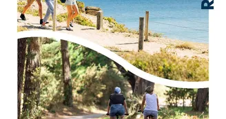
La Trinité-sur-Mer - Circuit les marais
La Trinité-sur-Mer
1 Avenue de la Baie
56470 La Trinité-sur-MerDuration : 2h Distance : 8 km Difficulty level: Easy Green signposting - All year - Possible MTB Between La Trinité and Carnac, 2 parallel "valleys" have had various exploitations (salt, oyster ...). They are as many wetlands to protect or restore. Departure: On the Men Du car park, admire the cove which has in its middle an island connected to the mainland by a cordon of sand accumulated by the currents game (tombolo). On the left, the tip of Kerdual hosts an archaeological site threatened by rising sea levels (a group of menhirs immersed and a tomb dating from the Neolithic). Then, back to the sea, take the path to the marshes of Kerdual to the road to Carnac-Ville. This marsh is crossed by a central path. Witnesses of exploitation in salt marshes from the 17th century to 1962 are still visible (basins partially filled by the vases extracted from the port of Trinité in 1968). 1 Turn right towards La Trinité-sur-Mer until the crossroads of Kervinio. 2 Turn left, cross the Kercado-Kerdual ridge (beautiful restored farmhouses). Go down opposite to the other "valley" occupied by the campsite Plijadur. 3 Turn right. Follow the path in the woods. At 550 m turn right. At the site of the camp, clays were extracted for the manufacture of tiles used for oyster farming in an old quarry (1870-1960). 4 Cross the village of Quéric. Turn right and join the Carnac road. Take it to the left. 5 Cross the road and take the path along the Quéric-Kerdual marsh. Barred in the south by the Poulbert remained almost wild, this marsh is home to seabirds and waders. 6 Join the Men Du street via a nice path and the starting carpark by crossing the Poulbert.
Find this route on the Loopi mobile app
Scan the QR code, save it as a favorite, or start the guidance, just enjoy!
Scan the QR code, save it as a favorite, or start the guidance, just enjoy!
Road surfaces
462 m on asphalt or tarred road
1.90 km on unknown surface in the Open Street Map database
433 m on rolling path (compacted sand, gravel, cobblestones)
2.94 km on trail and off-road track
This route is provided by: Office de tourisme de la Baie de Quiberon
Be cautious and prepared during your outings. Loopi and the author of this sheet cannot be held responsible for any problems that occur on this route.


