Erdeven - Sentier de la roche sèche
Erdeven > Erdeven
15 Rue Du Grand Large
56410 Erdeven125 Impasse De La Caserne
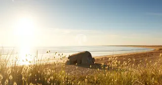
56410 ErdevenDuration: 1h15 Distance: 5km Difficulty level: Easy Yellow markup All year round - Possible mountain biking This path allows you to go to the beaches of Kerouriec and Kerminihy and reach the Roche Sèche. Departure: From Saint-Märgen square, go towards the back of the square, back to the town hall. Take rue Vachter Lenn on the left then rue Le Barh on the right for 30 m. Turn left onto rue de la Poste then right onto rue des Pierres Noires. Continue on the country lane. 1) At the pond, continue left. After the bends, join the road. Take it right then left at the exit of the village. Leave the road, turn right onto the country lane then left, at the next intersection. 2) At the road, turn left then 50 m further right on the path lined with stone walls. 3) Pass the crossing then, at the fork, turn left. Cross the moor. After 300 m, turn right at the intersection.Along the wetland of the old pond of Poulbé. Follow the chemin des Oyats until the road. 4) Turn left then right passing the gantry. Then take the first path on the left which leads to Roche Sèche and Kerouriec beach. Cross the dune massif, an exceptional natural area that is part of the Grand Site of France Gâvres-Quiberon. Observe the vestiges of the Atlantic Wall dating from the Second World War: in addition to the bunkers, winter storms allow you to regularly discover other defense elements hitherto buried under the sand. In 2018, a Belgian door, a tetrahedron and a piece of rail were discovered on the beach of Kerminihy.
Find this route on the Loopi mobile app
Scan the QR code, save it as a favorite, or start the guidance, just enjoy!
Scan the QR code, save it as a favorite, or start the guidance, just enjoy!
Road surfaces
1.72 km on asphalt or tarred road
2.97 km on unknown surface in the Open Street Map database
455 m on trail and off-road track
This route is provided by: Office de tourisme de la Baie de Quiberon
Be cautious and prepared during your outings. Loopi and the author of this sheet cannot be held responsible for any problems that occur on this route.


