Pluneret - L'anse du Téno
Pluneret
6 Route de Sainte-Avoye
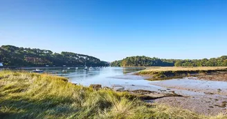
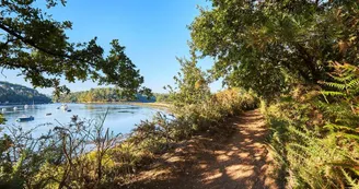
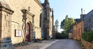
56400 PluneretDuration : 2h15 Distance : 9 km Difficulty level: Easy All year long - Wet in winter This hike allows to discover the richness of the natural spaces of the municipality. Departure: Parking of the village of Sainte-Avoye. To start the hike, two situation shots made by hand by a painter, based on an idea from the Pluneret Town Hall, allow visitors to discover the wealth of heritage that the maritime sector of the town offers. After reading, head towards the village of Sainte-Avoye then at the crow's feet, turn left to get away from the village, 1 Turn right in the path, continue in the valley, then the path leads into the pretty hamlet of Kerhel. Cross the hamlet, at the intersection turn right then left a few meters and take the path that sinks into the valley. 2 At the entrance of the Sensible Natural Area (ENS) of the Landes du Téno, follow the marked path through woods and wet moor to reach the other end of the site. The peasants who once exploited this site called it "lann viaz" (the heath of the mudflat). 3 At the chicane, turn left: the path becomes a coastal path and reveals the charms of the Sal estuary. It is a Ria, with mudflats and salt meadows where the waters of the Gulf of Morbihan, overhung by the bocage countryside, rush. See the Pont Sal Mill, a tide mill dating from the second half of the 19th century. Continue for 2 km. 4 In the hamlet of En ty Nyhuy, turn left to take the dike. Here, the marsh hosts many shorebirds all year round. Continue for 1.8 km. 5 At the crossroads, turn right to go up the meadow. From there, the view overlooks the Govillo Cove, the boat cemetery and the old Bono Bridge. 6 Continue on the wide path.500 m, take the hollow road on the right which leads to the village of Sainte-Avoye with, in focus, the Chapel. Listed as a Historic Monument, this Renaissance jewel was built in the 16th century. This chapel impresses with its high tower and its important dimensions. Inside, it reveals a decor of extreme finesse and is home to exceptional furniture: one of the rare jubés still preserved in Brittany. This remarkable work in polychrome wood is entirely carved with characters, fantastic animals and sets. Open from mid-June to mid-September. Go around the chapel then go back by the road to reach the car park.
Find this route on the Loopi mobile app
Scan the QR code, save it as a favorite, or start the guidance, just enjoy!
Scan the QR code, save it as a favorite, or start the guidance, just enjoy!
Road surfaces
8.64 km on unknown surface in the Open Street Map database
This route is provided by: Office de tourisme de la Baie de Quiberon
Be cautious and prepared during your outings. Loopi and the author of this sheet cannot be held responsible for any problems that occur on this route.


