Auray, Brech, Sainte-Anne d'Auray - Circuit VTT - La Vallée de Tréauray
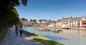
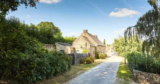
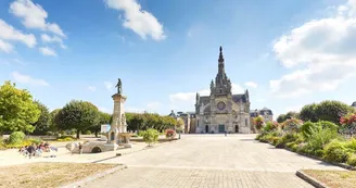
Duration : 2hDistance : 32 kmDifficulty level : Medium (average height difference: 450m) Course n ° 8 red As an extension of route N ° 7 "Around Auray", the circuit allows you to go up the valley of Tréauray, go around Sainte-Anne d'Auray, visit Brec'h and the village of Saint-Dégan before returning to the west bank of Loc'h. Departure: This circuit starts from the car park located behind the Alre'O Aquatic Center. The circuit map is available at the reception of the Aquatic Center. On the way back, you can take advantage of the swimming pool and its "balneotherapy" area for a moment of relaxation and recovery. Head towards the path and take it on the right towards Utting Park. When arriving at rue du Goaner, take the rural path of the new bridge on the right. Step by step : 1) With caution, cross Avenue de l'Océan for an ascent to reach the park that houses the Mausoleum of Cadoudal. Take the path downhill to reach the Priory of Saint-Cado and its chapel (16th-17th centuries), then go up and go to the Reclus stream that you will have to walk along. 2) After walking through some housing estates to reach the bridge that crosses the N165, dive towards the Auray river. Enjoy this walk on the quays leading to the famous small port of Saint-Goustan, its half-timbered houses (16th-18th centuries) and the ramparts of the Château d'Auray destroyed in 1558. 3) Leave the port and its small 18th century stone bridge, recently restored, and join the alleys of Auray a little further on the right. Cross the town of Auray then take a cycle path to reach the banks of the Loc'h. Several climbs and descents then follow to the Champ des Martyrs. 4) After 2 km on the D120, join a path leading near the Sainte-Anne-d'Auray campsite.Follow the signs to reach the center of the village, the Sainte-Anne Basilica and the Sanctuary. 5) Take a straight line and the paths along the town of Plumergat to reach the Pont de Brec'h. This passage offers a beautiful view of the Loc'h reservoir, located upstream of the dam. 6) Go up towards the village of Brec'h, cross it by various preserved paths before reaching the village of Saint-Dégan and its eco-museum, with a beautiful 17th century cottage and a 19th century farmhouse. 7) Go back to the west bank of the Loc'h, pass along the river before going up to the level of the water tower. 8) The return is common with route N ° 7. Join it by a downhill path. Pay attention to the markings and turn left on the Roman Bridge path leading to the edge of the Kerberluet subdivision. A first climb leads to the La Chartreuse district.Take the direction of the station, then of the village of Toulchignanet, before a descent then a last climb towards the Porte Océane and the Aquatic Center Alre'O. Possibility of continuing the hike with a connecting route leading to circuit N ° 1.
Find this route on the Loopi mobile app
Scan the QR code, save it as a favorite, or start the guidance, just enjoy!
Scan the QR code, save it as a favorite, or start the guidance, just enjoy!
Route development
79% shared roads
20% cycle paths
2% cycle routes
0.76% greenways
Road surfaces
9.18 km on asphalt or tarred road
16.1 km on unknown surface in the Open Street Map database
2.72 km on rolling path (compacted sand, gravel, cobblestones)
3.72 km on trail and off-road track
This route is provided by: Office de tourisme de la Baie de Quiberon
Be cautious and prepared during your outings. Loopi and the author of this sheet cannot be held responsible for any problems that occur on this route.


