Quiberon - Circuit cyclo - La boucle de Quiberon
Quiberon
5 Place Hoche
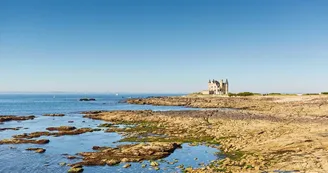
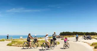
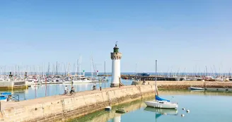
56170 QuiberonDuration : 1h30 (by bike), 3h45 (on foot)Distance : 15 kmDifficulty level : Medium "Boucle de Quiberon" signs On foot or by bike, the tour of Quiberon takes you from Armor to Argoat. Step by step : Departure: Take boulevard Chanard then the coastal road to Pointe du Conguel. Boulevard Chanard is lined with 19th century villas, witnesses to a time when industrialists from Lyon spent their holidays in Quiberon. As you pass, stop at the stele which commemorates the sinking of the Carl Bech, a Norwegian three-masted 45 meters long which ran aground in December 1911. Then pass in front of the Thalassotherapy then a little further on, see on the left the Dolmen du Conguel, Neolithic tomb classified in 1920 and excavated on several occasions. 1- Follow the coastal path.Pass in front of Fort Neuf, a former battery built in 1675 at the request of Louis XIV to protect Port-Haliguen from foreign squadrons and pirates. It will be abandoned at the beginning of the 20th century and then largely destroyed. Walk along the beach of Porigo and see the Fountain of Porigo. Continue towards the old port and the Place de Port Haliguen. 2- Take the quai des Sinagots. Before the pier, take the stairs to the left towards rue Surcouf up to rue du Mané. Turn right towards Colonie du Mané, continue along rue Bellevue. 3- Turn right rue des Galets then left rue Er Vadjuner. Cross Boulevard du Castéro. Take the path opposite. Join avenue des Druides, continue to the right towards rue des Goélettes. 4- Turn right towards the chapel of Saint-Julien. Follow rue de la Petite Côte to the sea. Walk along the coast. 5- After Beauséjour campsite, turn left at Chemin de la Vierge. Join the rue de la Vierge, follow the D768. Go through the level crossing. Turn right on Chemin du Manio.Along the way, see the Jardin du Ragot, the Ragot washhouse and its botanical path (path created and maintained by the Agapanthe association). At the top of allée de la Pompe, turn left then, after 100 m, left again. Before Kerniscob, see the vestige of the old semaphore: the tower of Locmaria (allows a 360 ° view of the peninsula, Houat, Belle-Île, Groix, Lorient and the Bay of Quiberon). 6- Take the allée du Sémaphore, turn right on the road to Kerné. Turn right towards Kerné. Cross the village towards the Kerné campsite. 7- To the left of the campsite entrance, walk along it. Follow the path to Manémeur. 8- Before entering the village, turn right. See the Menhirs of Mané Meur (Neolithic). Join the Beg er Lan roundabout. 9- Walk along the coast by the port and the pier. Admire the cliffs of the Côte Sauvage, sometimes over 20 meters high, which face the onslaught of westerly winds and the ocean. The Côte Sauvage has a varied and protected flora:maritime armenia, rock spergularis, blue dune thistles, spider ophrys. At the entrance to Quiberon, see Château Turpault (1910), an Anglo-medieval style mansion built by a spinner from Cholet (private property). Reach Place Hoche by the quays, Rue de l'Embarcadère and Rue de Port Maria.
Find this route on the Loopi mobile app
Scan the QR code, save it as a favorite, or start the guidance, just enjoy!
Scan the QR code, save it as a favorite, or start the guidance, just enjoy!
Route development
72% shared roads
27% cycle paths
17% cycle routes
7% greenways
Road surfaces
5.15 km on asphalt or tarred road
6.88 km on unknown surface in the Open Street Map database
705 m on rolling path (compacted sand, gravel, cobblestones)
2.79 km on trail and off-road track
This route is provided by: Office de tourisme de la Baie de Quiberon
Be cautious and prepared during your outings. Loopi and the author of this sheet cannot be held responsible for any problems that occur on this route.


