Crac'h - Circuit cyclo - Circuit de la rivière d'Auray
Crach
1 Place René Le Mené
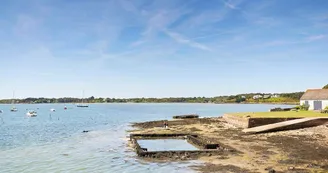
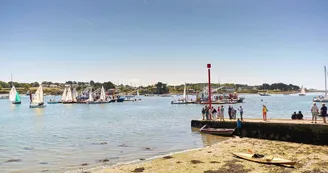
56950 CrachDuration: 1h10 Distance: 11.8 Difficulty level: Easy - All year long This beautiful circuit sends you to the Auray River on one of the remarkable sites of the municipality Departure - Place Le Mené, opposite the Town Hall. 1 Join the D28 at the traffic lights, and take the old road to the Spanish Fort, which starts behind the bus shelters. Take the road back to Fort Espanol, pass the campsites to reach the entrance to the Roman road, before the branch of the village of Kerourio. Take the Roman road for 250 m, then direction Kergaldan. 2 Cross the VC201 to join Kercado. Take the VC5 to get to the Spanish Fort through the village of Kercado. Go to the Spanish Fort which offers a beautiful view of the Gulf of Morbihan. Formerly Fort Sainte-Marie, this small port on the River Auray becomes "Fort Spanish" following the Spanish occupation that will last 8 years, from 1590 to 1598. 3 Returning to the village, a visit is required at Loqueltas, upstream of the Spanish Fort. Turn right after the village of Kercado to join Loqueltas. On the road, do not miss about 200 m left, the Calvary Kerherneigan. 4 Go down to the Auray river, on the Loqueltas land where, a few years ago, several oyster farms were in operation. 5 Take the same road for the return by the wooden bridge of Kercado, Kergaldan (attention crossing of road) and to join the Roman road, to take on the right, direction Kerfacile then Kermarquer. 6 In Kermarquer, to return to the town center in safety, take the bike path along the RD28 to the Petit Cosquer roundabout (use the sidewalk of the roundabout) and climb to the village of Petit Cosquer. Recover the way towards the town center by the Tourbillon.
Find this route on the Loopi mobile app
Scan the QR code, save it as a favorite, or start the guidance, just enjoy!
Scan the QR code, save it as a favorite, or start the guidance, just enjoy!
Route development
66% shared roads
33% cycle paths
Road surfaces
1.46 km on asphalt or tarred road
9.50 km on unknown surface in the Open Street Map database
567 m on rolling path (compacted sand, gravel, cobblestones)
23 m on trail and off-road track
This route is provided by: Office de tourisme de la Baie de Quiberon
Be cautious and prepared during your outings. Loopi and the author of this sheet cannot be held responsible for any problems that occur on this route.


